
There are certain DMs (me) who aren’t good at drawing and or mapping. For us, a few dollars a month towards various map makers helps us create our worlds. Even if you don’t commission specific works, the services of Dyson Logos (my favorite dungeons), Two Minute Tabletop (my favorite battlemaps), Deven Rue (my favorite regional maps), and Watabou (my favorite procedural maps) can add depth to your gaming sessions — even when you don’t use miniatures.
Oleg Dolya, the person behind Watabou, just released neighborhoods.
This is vital for me. Uprising & Rebellion takes place in large city. Having maps of districts and neighborhoods within that is important for the game. Being able to create one on the fly as my players head off script is vital. Players will always go off script. Just because you think they’re going to have a battle in the Docks doesn’t mean they won’t visit North Shore, the Ward of Mighty Trees, the University or Silk Row.

Will I have two or three of these printed out just for the flavor of the next neighborhood over? Yes.
Here are three other ways you can use the Neighborhood maps.
- Stitch together an assembly of several of them to create a city. The unnatural gaps make perfect sense as mountains, lakes, rivers, etc. A whole city at this level of detail would be interesting. Make certain to use the same color set for each.
- Some of the generations for the neighborhood map make sense as compact villages. Yes, Dolya has a village creator, but those don’t have wells, fountains, and ponds in them. The neighborhoods can.
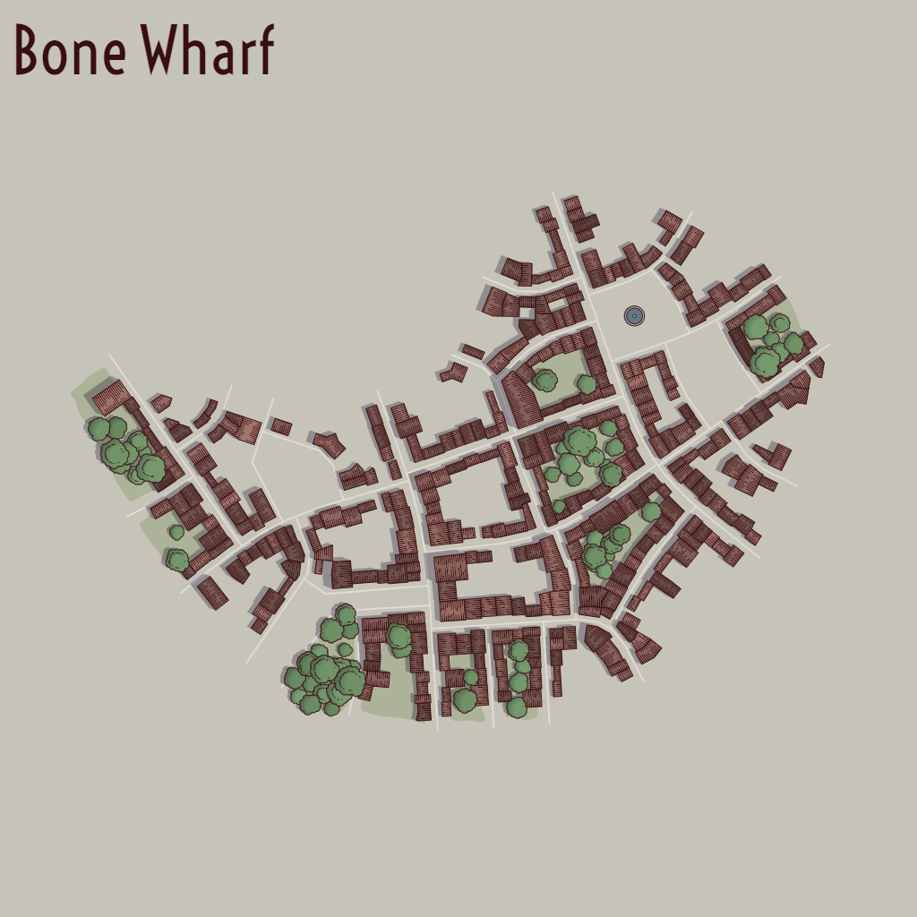
- The map can be an underground cavern in the Dwarven city trope. First shift the colors using the ‘0’ key to one that has some darkness to it. Pretend that the trees are mushrooms, and that the streets are the passageways and tunnels to the rest of the world. Bone Wharf is now a Mountain Dwarf city.
The key to using a procedural map is that you aren’t going to get exactly what you want, or even close to what you want. You are going to get a usable map, fast. Let the oddities of the creation guide you towards creating the people and the space. That long road running from lower-left to upper-right on Silk Row? That’s obviously the Silk Row itself. The fountain is where the various traders and merchants gather to discus their deals. The light smattering of trees are for the very richest of households, those that raise silkworms in the climate that isn’t proper for them. There are some roads that run parallel to the Silk Row, those are for supporting businesses, not the wealthy traders. The non-enclosed squares like the large one up-and-right are areas that are pack animal friendly. You are the DM (or when you use as a player to describe a hometown the creator). Let the algorithm take you to answers you could never find on your own.
What else do you see in Silk Row? Why is the dwarven city called Bone Wharf? What makes Bone Wharf unique?

Leave a comment